
Geocoding Automation
Collecting address data is simple, but converting it into usable location data is often unreliable.
A webhook-based system that converts addresses into coordinates in real time, handles errors, and routes clean data into workflows.
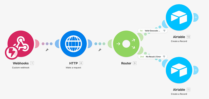
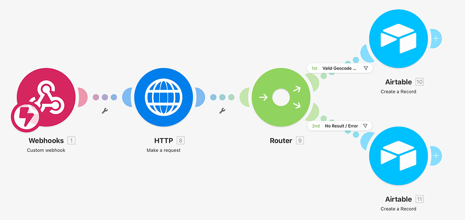
Every address submitted gets geocoded, logged, and either stored with coordinates or flagged with a reason — automatically, with zero manual handling.
Collecting addresses through lead forms is only useful if those addresses can be turned into actionable location data. Manual geocoding does not scale and most automated systems fail without any record of what went wrong. This pipeline receives every submission instantly via webhook, geocodes the address in real time, and routes the result to the right place. Coordinates are stored and VA-ready on success while errors are classified and flagged for review on failure.
The Impact



How We Thought

 Created to ensure every address is processed correctly, with clear handling of errors so no data gets lost or ignored.
This keeps data reliable and ready for immediate use by the team.
Created to ensure every address is processed correctly, with clear handling of errors so no data gets lost or ignored.
This keeps data reliable and ready for immediate use by the team.
1. Identifying Where Data Was Being Lost
Addresses Without Coordinates Are Just Text
Collecting lead addresses through forms is only the first step. Without latitude and longitude coordinates those addresses cannot be used for routing, territory assignment or any location-based logic downstream. The real problem was that failed geocoding attempts were disappearing silently with no record of what went wrong or which addresses needed to be fixed.
2. Making the Webhook Work for Any Upstream Source
One Entry Point That Works With Any Tool
Rather than building the system around one specific form or platform we designed the webhook to receive address data from any source. Instagram Lead Forms, website forms or any CRM can send a submission and the pipeline processes it identically every time. This made the system immediately reusable across different lead sources without any rebuilding.
3. Routing on Result Quality Not Just Status Code
A 200 Response Does Not Always Mean the Geocode Worked
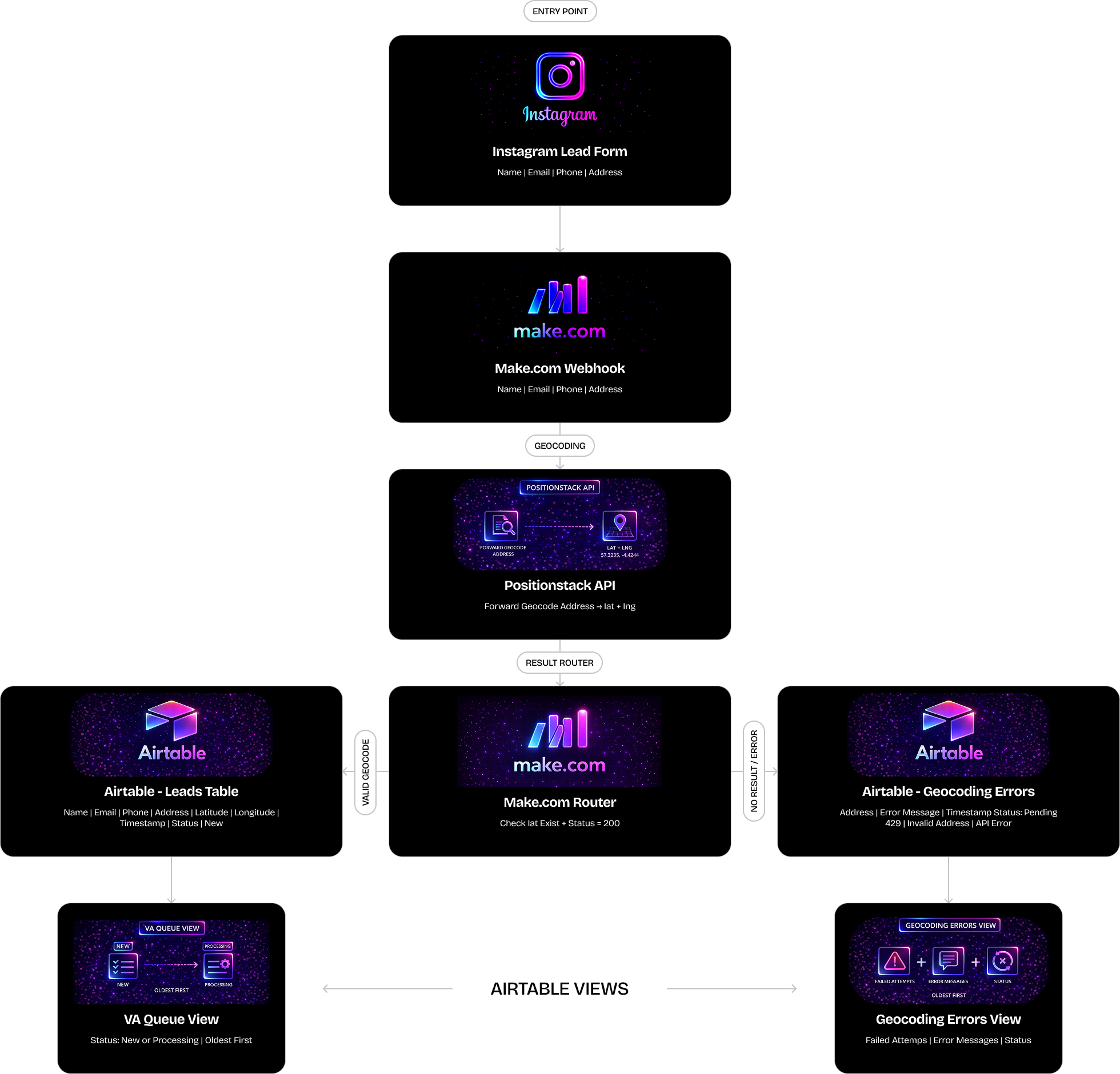
The Positionstack API can return a 200 status code with no usable coordinates inside the response. We built the router to check both the HTTP status and whether latitude actually exists in the returned data before deciding which path to take. This prevents incomplete or empty data from being written into the Leads table as if it were a successful result.
4. Classifying Every Failure Individually
Not All Errors Mean the Same Thing or Need the Same Fix
A rate limit error, an invalid address and a missing result each mean something different and require a different response from the team. Rather than logging a generic failure message we built classification logic that identifies which type of error occurred and writes a specific message to the Geocoding Errors table so the VA knows exactly what action to take on each record.
5. Building the Views for the People Who Use Them
Airtable Built for the Team, Not Just the System
The Airtable base was not designed as a raw data dump. Two custom views were built specifically around how the team actually works. The VA Queue shows only active leads with status New or Processing sorted oldest first so the team works in the right order. The Geocoding Errors view shows only failed lookups with their classified error messages so review and resolution can happen without any manual filtering.
Architecture Snapshot
The Stack


Systems Delivered


What Changed
- Every address submitted through a lead form is now automatically converted into GPS coordinates within seconds
- Failed geocoding attempts are no longer lost. Each one is captured in a separate table with the reason clearly written out
- The VA team can open Airtable and immediately see which leads are ready to action and which addresses need review
- The analytics team no longer receives manual geocoding requests because the system handles every submission on its own
- Location data is now clean, consistent and timestamped across every record in the database

 See How We Work

More Work Like This

Speak Directly With the People Who Build



+1.svg) D 908 - PNTC, Times Of India Press Rd, Prahlad Nagar, Ahmedabad, Gujarat - 380015, India
D 908 - PNTC, Times Of India Press Rd, Prahlad Nagar, Ahmedabad, Gujarat - 380015, India Langenthalstrasse 8A, 4912 Lotzwil, Switzerland.
 1204 Al Manara Tower, Business Bay Dubai, United Arab Emirates





 Built with enterprise standards for security, data handling, and delivery.Partnered with & recognized by global technology platforms.